AG Drone Services
Precision drone spraying with detailed crop surveying and property mapping
What we spray
Fertilizer (chemical and granule)
Herbicides
Pesticides (insecticides)
Fungicides
Arsenal (chemical land clearing)
Using Drones in Ag is the Future
Ag drone spraying is to stay. Chemicals (pesticides, herbicides, and fungicides) are far too expensive and too dangerous to allow continuous waste via drift, over large areas. Ag Drones, like the XAG P150 (seen here) are perfect for small, medium, and often large farms of multiple types of row crops, nut and fruit tree orchards, and even pasture areas.
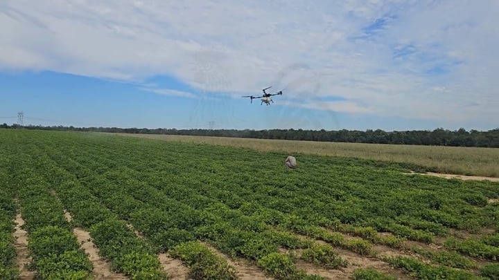
Using Ag drones is not just for "spot" treatments, even though they can be used for this purpose. They can lay down more product per pass than nearly every traditional crop duster airplane or helicopter, for less money and more precision.
What is the "Flyest Farm" process to spraying?
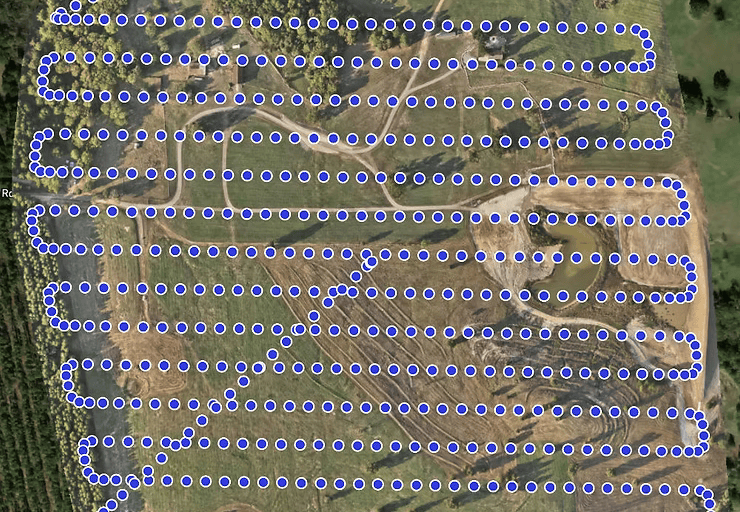
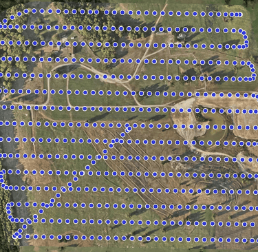
Most often before we do anything, during our initial inspection we will conduct a "mapping" of your field or area(s) with one of our mapping and surveying drones. We will create an orthomosaic map to determine the boundaries and obstacles that may be present - like center pivot systems, equipment or animals. After this is done, we will evaluate the boundaries, discuss this with the farmer, and mix the provided products.
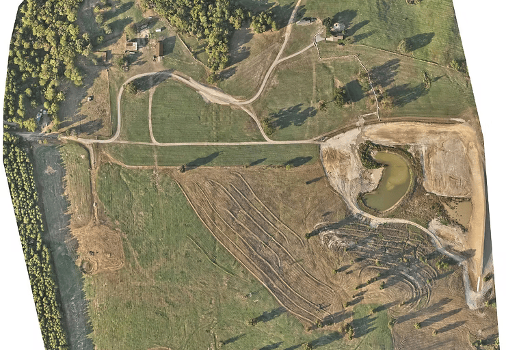
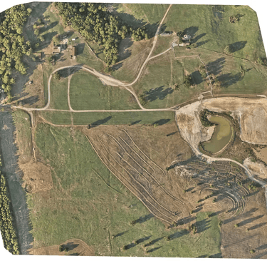
Orthomosaic Mapping
Whether we spray for you or not, EVERY FARMER should have an Orthomosaic Map of their fields. Post planting and Preharvest. Anything less is farming blind.
An Orthomosaic Map is a map created by a drone (or aerial vehicle) that stitches together hundreds of individual photographs using GPS coordinates to create an up-to-date image of a property or farm. This stitching, or "photogammetry," is a must for every property owner and ABSOLUTELY a necessity for every farmer.
Where we spray
Row Crops
Pecan and Nut Trees
Vineyards
Open Fields and Pastures
Weeds and Unwanted Grasses
Farm Equipment and Field Damage | Crop Insurance Claims
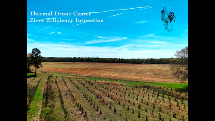
Farm Equipment is EXPENSIVE. Flyest Farm has drones to perform various inspection tasks; such as Center Pivot Irrigation System inspections, crop damage inspections, and various other building and equipment damage inspection photo/video services.
Whether its hail damage, tornados, floods, drought, weed, insect, and animal damage to crops or equipment or fire, our drone pilots can help you get the documentation you need to make a successful claim.
FAQs
How much do you charge?
Our 2026 pricing for Ag Drone Spraying and Spreading depends on the size of the field, the amount of product to be laid down, and in some cases, the distance to travel. We have a minimum field size of 40 acres for spraying.
Our 2026 pricing for Orthomosaic Mapping (as a service alone, not tied to spraying) is priced depending upon the complexity of the mapping job. Most traditional farm maps are done in Class G airspace. If no special permissions are needed from the FAA, then normal pricing can be anywhere between $12/acre to $150/acre (solar panel field or construction site). Larger fields require much more time and stitching together.
Our 2026 pricing for Insurance claim inspections and/or Ag equipment inspections are by the hour. If an Orthomosaic map is needed for an Ag Insurance Claim, then we will ONLY map the reported damaged field. These are charged by the Acre of field inspected.
If we have to fly to your location, we will work out fuel costs.
How do you prepare to spray?
Do you print the Orthomosaic Maps for wall papering?
Is there a fuel Surcharge?
Yes and No. We do not add a fuel surcharge for spraying or mapping missions on fields or properties within Early County, GA or counties that border Early County. Outside of that, until all of this international craziness is behind us, we do.
Prior to spraying, we will come to your property or field(s) and map out the area to be sprayed (if close enough to Early County). We do this so we can quickly set up the next morning or day and get going.
We do not. However, we can find you a non-affiliated third party producer that can print whatever size physical map you need. The images are high quality with centimeter's small pixels, so it will look great on great paper. We do provide you with the file and some editing (background) for your records or computer wallpaper screen.
Fees | Costs
Contact
Malik Leigh, J.D.
Phone
fly@flyestfarm.com
405.921.6935
© 2026 by Flyest Farm, LLC., All rights reserved.